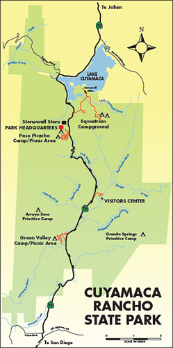
 One of my favorite San Diego-area State Parks is Cuyamaca Rancho, a 26,000 acre tract of land lying in the mountains about 50 miles east of the City proper. The park has it all - hiking, mountain biking, horseback riding, grassy meadows, rocky mountains, streams--and ghosts of pine forests left by the 2003 Cedar Fire.
I split my time at the park roughly 3:1 mountain biking to hiking. Over the last couple of weeks, I visited twice, first hiking the Cold Spring Trail (about a 3 mile round trip), then mountain biking the Upper Green Valley Fire Road/Upper Green Valley Trail combination (about an 11.5-mile roundtrip). If you'd like to take the time, I'd like to share some photos of the two trips with you.
The Cedar Fire
To understand the condition of the Park in 2011, you have to know a little recent history - specifically, about the 2003 Cedar Fire. 2003 was a very dry year, and tinder lay in the forests of Cuyamaca Rancho like a match waiting to be struck. A hunter in the hills west of Cuyamaca became lost, and set a signal fire in an attempt to be found. Within hours, strong Santa Ana winds (blowing form the desert towards the shore) blew the fire west to burn over 100,000 acres. Those winds were replaced by shore winds that blew the fire back east towards Cuyamaca Rancho.
To get an idea of the size of the fire, see the video at this link, and the time-lapse video below, taken from the weather station at Mount Laguna, about 12 miles east of Cuyamaca Rancho. The three peaks in a row on the right side of the fire are, from left to right, Cuyamaca Peak, Middle Peak and North Peak, which lie in a row on the west side of the Park. At some points, you can see the fire practically explode when it hits the pine-forested slopes of the three peaks:
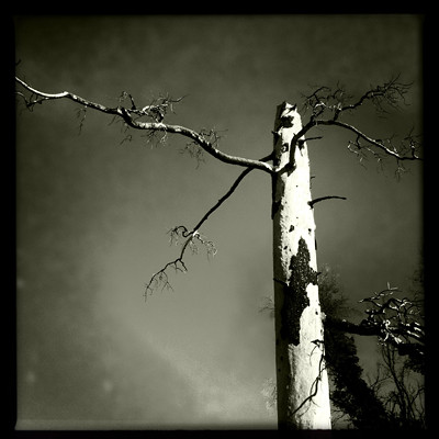
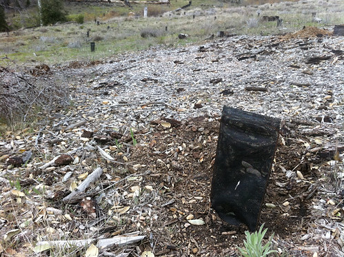
The fire burned so hot it not only killed the trees, but their seeds, as well. I remember going to the Park for the first time in 2005, and noticing how the trail surface was powdery and ashy; the fire had been hot enough to burn even the organic material in the soil. In an effort to mitigate the damage, Cal Fire and partners have begun planting seedlings to help reforest areas of the Park:
Since then, Cuyamaca Rancho has experienced a significant recovery. Follow me for two outings to get an idea of where the Park is now, and how valuable it still is.
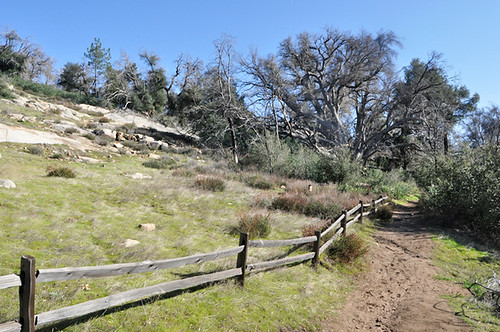
The Cold Stream Trail
The Cold stream Trail starts at the Park Visitor Center and follows Highway 79 north. The trail initially follows a small grassy meadow. While some of the trees along the trail have been long dead:
the meadow, and much of the surrounding forest, have made a remarkable comeback:
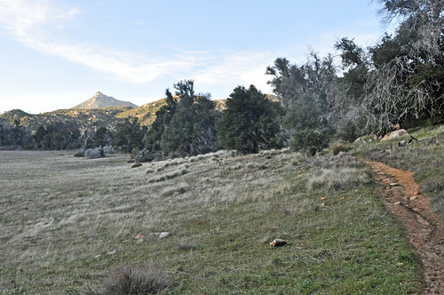
Stonewall Peak, a scenic highlight of Cuyamaca Rancho, is visible in the background.
There's been a fair amount of rain and snow in the Cuyamaca Mountains the last couple of months, so Cold Stream was running pretty well over a small set of falls, the last feature before a turnaround point we took (the trail extends another mile or two northward):
* * * * * * * * * *
Upper Green Valley Trail
The next weekend, I hopped on the mountain bike and rode one of my favorite routes in the Park, the Upper Green Valley Trail, which starts from the same parking area as the Cold Stream Trail. The trail, which starts out as a fire road, roughly parallels the ambitiously-named Sweetwater River (it's no more than a creek) up Green Valley. The valley is wide and lush at the beginning:

Along the way, I stopped by an area where rangers had protected tree seedlings:
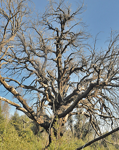
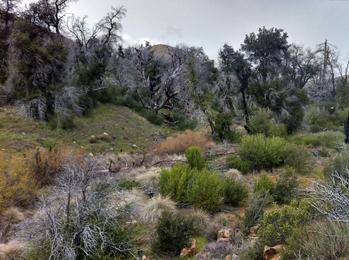
The riverbed itself is an interesting mix of freshly-growing desert scrub (mostly creosote bush), grasses, and burned trees still standing from the cedar Fire:
Following the trail up (it's a more or less continuous climb up the valley), you eventually break out of the trees and up to a pass between the two ridges defining the valley. Looking back, you can see the trail on the right, the valley spread out in the centers, and a private access road to the left:
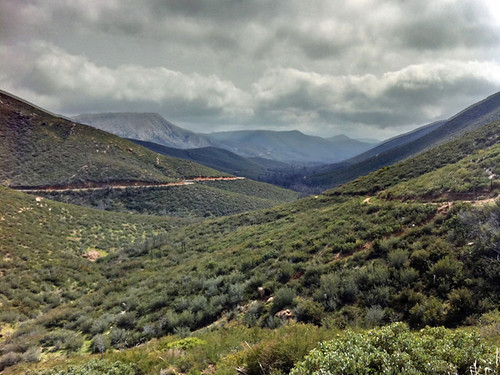
This part of the trail gives you a panoramic view that is especially scenic on a partly cloudy day (it was quite windy when this footage was shot):
* * * * * * * * * *
These two trails are only a small sampling of the looks Cuyamaca Rancho State Park gives visitors. I'll post other trails in the future when I get to them. In the meantime, get outdoors and enjoy the trails close to your home; it will connect you to yourself as well as to the land.
No comments:
Post a Comment